Name (English): Tung Lung Chau
Name (Chinese): 東龍島
Category: Outdoor Activities
Address (English): Tung Lung Chau
Address (Chinese): 東龍洲
Address Google Map Link: https://goo.gl/maps/PnWiYhh78fBCsqc8A
Address longitude and latitude: 22.249210848856645, 114.28934872937373
Nearest MTR Station: Sai Wan Ho Station Exit A
Nearest MTR Station Google Map Link: https://goo.gl/maps/5rgYSyPmpeJYuyaA9
Nearest MTR Station longitude and latitude: 22.28214986747937, 114.22210368152204
How far from the nearest MTR Station: 5-minute walk to take the ferry
Opening Hours:
MON 00:00 – 23:59
TUE 00:00 – 23:59
WED 00:00 – 23:59
THU 00:00 – 23:59
FRI 00:00 – 23:59
SAT 00:00 – 23:59
SUN 00:00 – 23:59
Budget (per person): HKD100
Recommended Time to Visit: Weekend 9 am- 5 pm
Accessibility Note: easy access
Reminder: Check the Ferry schedule before visiting, the ferry journey from Shau Kei Wan Typhoon Shelter takes around 45 minutes.
Tung Lung Chau (東龍島) is now known as the ideal outlying island for exciting outdoor activities like rock climbing, ziplining, and camping. However, beyond the holiday routines that energize the island, Tung Lung Chau is rich in history and stories, often overlooked by the average visitor.

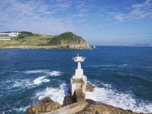
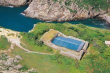
Tung Lung Chau is located at a strategic location between two key channels, Fat Tong Mun (佛堂門) and Tathong Channel (藍塘海峽), both leading into Victoria Harbour. As such, it has always been of defensive importance throughout history. A few marine defense systems can still be seen on the island. Tung Lung Fort in the north of the island dates back to the Ming and Tsing Dynasty and Tathong Point Lighthouse in the south was built by the Japanese during their invasion in the 1940s. They make excellent checkpoints for those who are interested in the historical development of the island.

After WWII, marine defense is no longer necessary in a world of relative peace. Tung Lung Chau started undergoing some changes in land use in response to the needs of modern society. . In the 1960s, Nam Tong Chuen (南堂村), the only piece of flatland in the west of the island was being used for the relocation of pig farms from Shau Kei Wan.
Recently, ruins of the Song dynasty were found to be used in building the pig farm structure. Further archaeological excavation suggested that a temple of the Song Dynasty might have been erected at the same location. You can even find tiles dated back to the Song Dynasty along the coastline next to the village. However, as these are privately owned land, large-scale archaeological excavations cannot be performed. As a result, we are still unsure of the archeological history of the site.

Tung Lung Chau has a wealth of nature and activities suited for visitors with different interests. Spare a day for the island and I guarantee you will not be disappointed.
#TungLungChau #hiking #rockclimbing #ziplining #camping #nature #outlyingisland #discoverhongkong #explorehongkong #hker #hkhiking #hkinstagram #hkoutdoor #hkphotography #hongkongnature #hongkongtravel #ilovehongkong #instahk #instanature #naturelovers #outdoors #visithongkong


